VOILES ET VOILIERS’ COLUMN
My tool bag
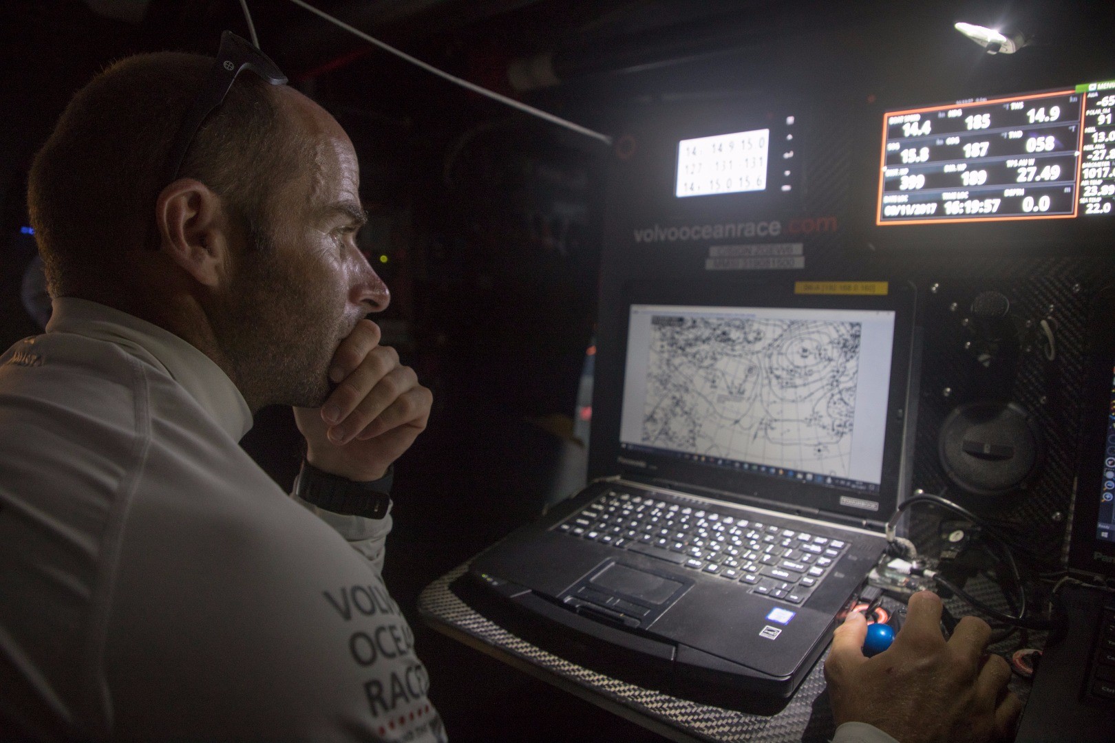
Electronics
The electronics are one-design right across the fleet: WTP from B&G. WTP is a custom version of the B&G instrument system, which means you have access to the heart of the system so you can set the parameters to suit you. You can virtually do anything you want with it, provided you know how to use it properly… There are a number of very important sensors: 3 GPS, 3 compasses, 2 wands, 4 speedos, a depth sounder, load and trim sensors pretty much all over the rig, a barometer, a thermometer, in short, plenty to keep you amused and a real hive of activity!
Computing
The two computers are also one-designs, but you can install whatever tools you like on them. We’re compelled to run Deckman constantly because of WTP, but I don’t just use it to have access to the WTP (calibration, choice of sensors, data smoothing, etc.). Here is the other software I use on “Turn The Tide On Plastic”:
Adrena is my main work tool: cartography, navigation, weather and strategy assists with performance and you can pretty much do everything with it! I’ve got a good handle on it as I’ve been using it for a number of years and the dialogue with the development team is easy. To my mind, it’s the most polished, high-performance and powerful piece of software around today. I’d be lost without it!
I also use Expedition a bit, but more as a safeguard. It has some interesting functionalities, but it remains marginal. Both pieces of software operate in a fairly similar way, hence it’s not overly complicated to switch from one to the other. A while ago, I slipped into the shoes of an engineer come trainee computer analyst to fashion a few links between the two pieces of software, so I could transfer the results of the routing obtained using Expedition on Adrena and then compare the two.
We also use Wind Bag, which is a small tool, which enables you to track AIS targets in the form of a spreadsheet. You enter the MMSI number of the fleet’s boats and you have the values (SOG and COG), which are calculated and smoothed out over time. This tells you whether you’re faster or slower than your playmates. It’s a terribly addictive bit of kit as you tend to have your eyes riveted to the screen to find out if you’ve achieved 100% of your performance polars in relation to the other boats. Obviously, that only works when we’re within AIS range, namely a maximum of around 7-8 miles for the Volvo 65s.
Next up, another piece of software that’s constantly running is the “On-Board Assistant” from Sailing Performance. This software allows the acquisition of data coming from the instrument, added to which are configurations related to the sails, ballast tanks, daggerboards, stacking position, outrigger and any other parameter, which seems to us to be relevant for integrating in the performance analysis. At the end of each navigation session, all this data is processed with the help of other software from Sailing Performance to enhance our understanding of the boat (which are the most high performance configurations etc.?) and then refine our polars and our sailects (display of the sail ranges).
Finally, I use a little piece of software that enables you to compare the Grib files against each other and against the data recorded by the instrument: which weather model is the closest to the reality we experienced on the water? How long is the forecast generally reliable for? The idea here is to be able to apportion credit to one model more than another with the help of concrete figures and tangible elements.
And finally, in addition to all that, I have an external display (iPad in a watertight case), which I solely use during the start phases and the “In-Port” races at the stopovers, with a specific Adrena screen for the starts (line advantage, timing, etc.). Once we’re racing, you get the times for the laylines, the next mark, the course and the distances until the next tack, the angle in relation to the wind, the perfect sail, etc.
Weather tools
The company Great Circle, via its Squid software, is the Volvo Ocean Race’s exclusive supplier. We have a download quota of 0.5GB per leg.
Each navigator is free to download the data they want via Squid, so long as they don’t exceed the quota: isobaric charts, Grib files, observations, satellite images and the scatterometer (observation of the wind via satellite). Countless data is available. It’s down to each person to make their choice and then process the data.
Rankings
We receive a file with the position of the competitors every 6 hours. You input this file into Adrena to view it on the screen and find out if you’ve gained or lost ground, etc. You can also simulate the routing for our rivals to find out whether or not a different option to our own is favourable.
In short, there’s plenty to keep us busy!